The Cahuilla homeland in California was bounded on the north by the San Bernardino Mountains; on the south by the northern Borrego Desert; on the east by the Colorado Desert; on the west by the present-day city of Riverside. The designation Cahuilla is said to mean “masters” or “powerful ones.” As a tribal designation, Cahuilla is more of a linguistic designation than a governmental or political one: the many different Cahuilla villages tended to be autonomous and there was no single overall governmental structure which united them.
The most important social structure among the Cahuilla were their patrilineal clans. There were about a dozen independent clans. In his entry on the Cahuilla in the Encyclopedia of North American Indians, Lowell John Bean reports:
“These clans controlled separate territories of several hundred square miles and maintained their own political authority. Each clan was allied through ritual systems that provided political stability and networks for economic exchange. Each clan was dialectically different from the others.”
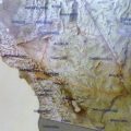
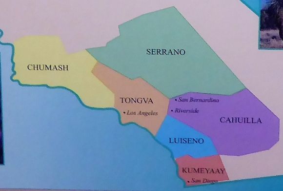 The map shown above shows the territories of the six Southern California Indian nations.
The Cahuilla Continuum was an exhibit at the Riverside Metropolitan Museum authored and curated by Sean C. Milanovich. The exhibit told the story of the Cahuilla from creation to the present day. According to the Museum display:
“The Cahuilla have been in Southern California since time immemorial. After the death of their Creator Múkat the Cahuilla went on a long migration before returning home. The Cahuilla have made this area their home—taking care of the land, the water, the trees and plants, and the animals. They have learned to adapt to survive on the desert floor in the heat and on tops of mountains in the cold.”
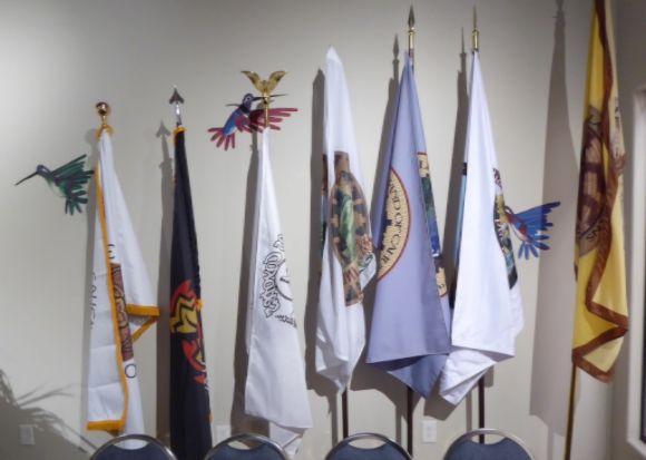 Shown above are the Cahuilla flags.
The display on Sovereignty (Tévol Téweaweyum) states:
“Múkat (the Creator) created the Cahuilla as a sovereign people. They had their own political structure and leaders, a system that worked for them since creation. The Cahuilla have always been on this land; the government never relocated them to Indian territory.”
The Cahuilla lived in villages of 100-200 people. Prior to European contact, it is estimated that the Cahuilla population numbered about 6,000. With regard to their political organization, Lowell Bean and Harry Lawton, in their book The Cahuilla Indians of Southern California, write:
“A net (or chief) served as ceremonial leader, economic administrator, political leader, and adjudicator. He was assisted by another official called a paha. Other position also carried political weight. Medicine men or pulem were often included in the decision-making of the group.”
In 1852, the Cahuilla under the leadership of Chief Genio signed the Treaty of Temecula with the United States. The treaty was supposed to provide them with a reservation that was 30 miles wide and 40 miles long. The treaty, however, was not ratified by the Senate and therefore the reservation was not created. According to the display sign:
“The California politicians who lobbied against ratification were more interested in acquiring more land for non-Native development in Southern California.”
In 1876, the United States began to establish a series of small reservations for the Cahuilla. In his entry on the Cahuilla in the Handbook of North American Indians, Lowell John Bean reports:
“After 1891, their economic, political, and social life was closely supervised by the federal government. Government schools were opened in which young Cahuilla were trained in rather menial roles, Protestant missionaries became influential, and much traditional Cahuilla life was altered. Cahuilla cultural institutions were generally suppressed, particularly religious and political ones.”
One part of The Cahuilla Continuum exhibit describes the nine Cahuilla bands that exist today.
 The map shown above shows the current Cahuilla reservations.
Agua Caliente Band of Cahuilla Indians
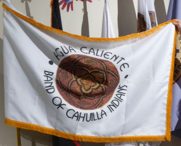
The Agua Caliente Reservation was established by Presidential Executive Order in 1876. The Agua Caliente made their home around the mineral hot spring at the base of San Jacinto Mountain. The spring is a sacred place with medicinal and healing powers.
Augustine Band of Cahuilla Indians

The Augustine Band of Cahuilla Indians has lived in the Coachella Valley and surrounding mountains for more than 3,000 years. Their 600-acre reservation was established by an act of Congress in 1891.
The Cabazon Band of Mission Indians
The Cabazon Band of Mission Indians is located in Indio. Their reservation was established by Presidential Executive Order in 1876. The original reservation included three parcels of land with 2,400 acres, but the Southern Pacific Railroad would later claim 700 acres of reservation land.
The Cabazon Band is named for chief Cabazon who was a leader of the Desert Cahuilla from the 1830s to the 1870s. The band’s main village, Pal Setaxat, was near the present city of Indio.
The Santa Rosa Band of Cahuilla Indians
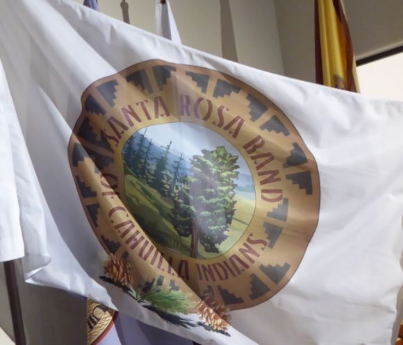
The Santa Rosa Band of Cahuilla Indians, whose reservation spans 11,021 acres of land in the Santa Rosa Mountains, are Mountain Cahuilla who are descendants of the Guanche-Pakiktem, Costai-kiktem, and Sawish-pakiktem clans. Their reservation was established in 1891.
The Los Coyotes Band of Cahuilla and Cupeño Indians
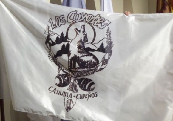
The Los Coyotes Band of Cahuilla and Cupeño Indians are Mountain Cahuilla and Cupeño whose reservation, established by Presidential Executive Order in 1889, is in San Diego County. The 25,000-acre reservation is between the Cleveland National Forest and the Anza-Borrego Desert State Park.
According to the Museum display:
“Much of the reservation is remote, mountainous and environmentally sensitive and therefore not appropriate for development. It supports the biodiversity of the region as a diverse wildlife habitat.”
The Morongo Band of Mission Indians

The Morongo Reservation was established in 1876 by Presidential Executive Order. Originally, the reservation was named Portrero Ajenio after a Cahuilla “captain” (i.e. chief). The Federal Government later renamed it the Morongo Reservation. According to the Museum display:
“The name Morongo came from John Morongo, the first official Captain of the San Gorgonio Agency and leader of the Serrano Maarenga clan. During the time of his leadership, the Serrano people of the northern mountains and desert relocated to live with the Cahuilla at Malki.”
The Malki Museum, established in 1964, was the first California Indian owned and operated museum. The museum displays the heritage of the Cahuilla and Serrano peoples.
 Shown above is a bow and arrow made by Tomas Cisco on the Morongo Reservation between 1890 and 1917. Tomas Cisco was born around 1845 and served as a tribal policeman on the reservation He died in 1921.
Cahuilla Band of Indians
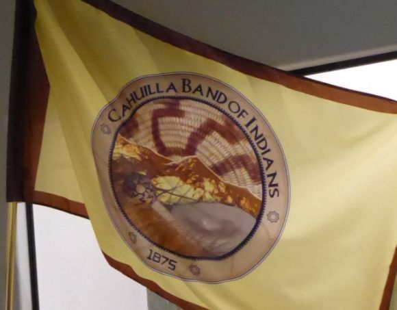
The reservation for the Cahuilla Band of Indians was established inn 1875 near Anza, California, in Riverside County. The Cahuilla Band are Mountain Cahuilla.
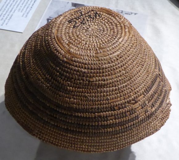 Shown above is a basket hat (yá’mahval) made by Antonia Apapas Casero sometime before 1917. She sold her basket cap to photographer Edward H. Davis.
Ramona Band of Cahuilla Indians
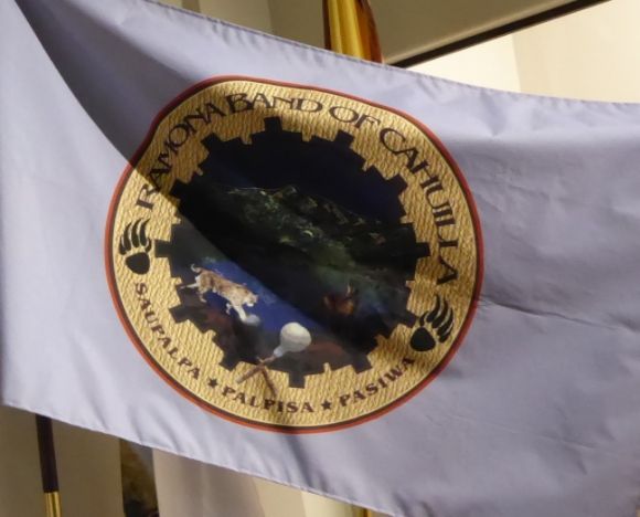
The reservation for the Ramona Band of Cahuilla Indians was established in 1893. Tribal members are direct descendants of the Apapatchem Clan.
According to the Museum display:
“The Ramona Band of Cahuilla was the first tribe to develop its entire reservation off-grid, using renewable energy as the primary power source. The decision to go off-grid and limit impacts to the environment furthered the Ramona Band’s desire to protect and preserve areas such as gathering places, village sites and ceremonial sites located on and off the Reservation.”
Torres Martinez Desert Cahuilla Indians
In 1876, the Torres Reservation and the Martinez Reservation were established by Presidential Executive Order in the lower Coachella Valley. The reservations were named for the Toro Indian Village and the Martinez Indian Agency. Under the Mission Indians Relief Act, in 1891 the two reservations were joined.
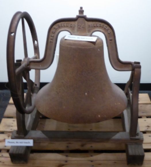 Shown above is the bell from the 1907 Torres Martinez School


Leave a Reply