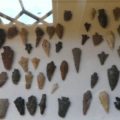
The Fort Dalles Museum in the Dalles, Oregon, has a number of old photographs documenting Indian fishing on the Columbia River prior to the completion of the Dalles Dam which inundated the traditional fishing areas.
Background
For more than 15,000 years Indian people have lived adjacent to the Columbia River. The river provided them with countless salmon which they harvested with nets and spears. The annual salmon run provided Indians with a nutrient-rich food as well as a valued commodity for barter. It is estimated that the aboriginal salmon harvest along the Columbia River was about 18 million pounds. Among the Indians along the Columbia River, it is estimated that salmon provided at least 40 percent of their total calories. In his book Northwest Passage: The Great Columbia River, William Dietrich reports:
“It was roasted, boiled, smoked, or dried into a flaky power that could remain edible for several years. Big games, such as deer and elk, probably made up no more than 10 percent of the diet.”
On of the important fishing areas was located about 10 miles east of present-day The Dalles, Oregon. It was called Wyam by the local Indians and is known today as Celilo (seh-LIE-low) Falls. This was not only a major fishing site, it was also a trading site.
At Celilo Falls, people constructed platforms out over the water so that the salmon could be more easily speared. Writing in 1859, Lieutenant Lawrence Kip, in the book Indian War in the Pacific Northwest: The Journal of Lieutenant Lawrence Kip, describes Indian fishing on the Columbia River:
“Little bridges are thrown out over the rocks, on which the Indians post themselves, with nets on hoops, to which long handles are attached. With these they scoop up the fish and throw them on the shore. They are then pounded fine between two stones, cured, and tightly packed in bales of grass matting lined with dried fish-skin, in which state they will be kept for years.”
Often the fishing sites, such as those at Celilo Falls on the Columbia River, were owned by families who erected fishing platforms. Kinship structured the access to these sites. In an article in the Oregon Historical Quarterly, Andrew Fisher reports:
“The rights to a particular cliff, rock, island, or scaffold descended through inheritance, and the owners had to grant permission for others to use it.”
According to anthropologist Eugene Hunn, in his book Nch’i-Wána, “The Big River”: Mid-Columbia Indians and Their Land:
“The owners felt bound to share their bounty with both relatives and strangers. Strangers were allowed to catch one fish; elders who came to watch the action were also due a fish as a common courtesy.”
In the hills above the river Indian people gathered roots, plants, and berries.
The Dam
In 1957, The Dalles Dam flooded Celilo Falls and silenced this voice. The falls is now beneath the lake-like waters of a human-controlled Columbia River. Historian Roberta Ulrich, in her book Empty Nets: Indians, Dams, and the Columbia River, reports:
“Weeping Indians stood on the shore and watched the white man’s dam drowned their homes, their livelihood and the center of their culture.”
Archaeologists James Keyser, Michael Taylor, George Poetschat, and David Kaiser, in their book Visions in the Mist: The Rock Art of Celilo Falls, describe it this way:
“People gathered to watch as the inundation slowly filled the canyons and sites of ancient villages, radically changing the face of the Columbia Gorge forever. The roaring falls at Celilo, the focus of fishing and a vast trading network for thousands of years, as well as a center of social and mythological importance, gradually fell silent as it too sank beneath the rising tide of water and the needs of modern ways of life.”
Within six hours, Celilo Falls, an important resource and spiritual site, disappeared beneath the rising waters.
According to one roadside historical sign:
“Bereft of their ancestral fishery and gathering places, local Indians are awaiting enactment of Public Law 100-581 passed in 1988, that will provide 26 fishing access sites between Bonneville and McNary Dams. This helps guarantee the way of life for the Indian fisher.”
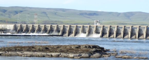 The Dalles Dam is shown above.
Old Photos
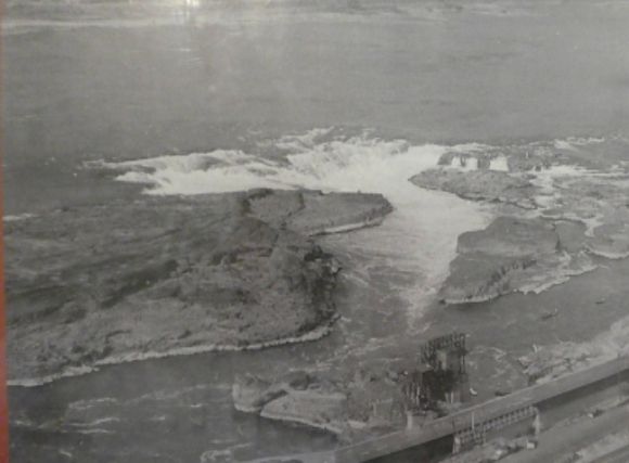 Shown above is Celilo Falls in 1955. A commercial, non-Indian fishwheel can be seen in the lower center of the photograph.
 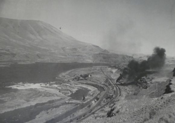 Another view of Celilo Falls in 1947. The smoke is from a steam-power freight train.
 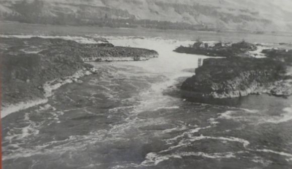 Celilo Falls in 1944.
 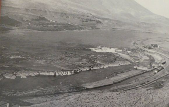 Celilo Falls in 1940.
  This photograph was taken in 1950.
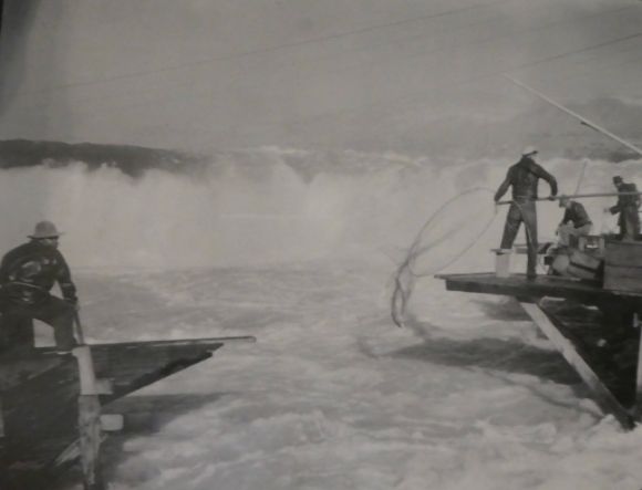
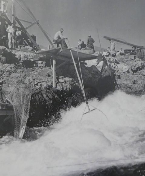 This photograph was taken in October 1954 at the mouth of Downes Channel.
 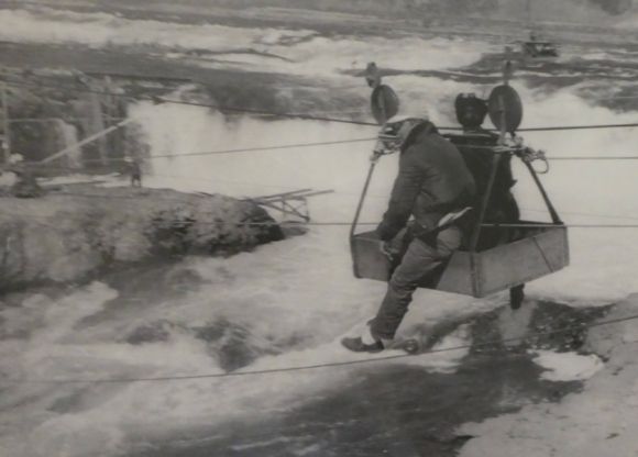 This photograph, taken in 1956, shows fisherman at Celilo Falls riding one of Seufert’s Cableways from the Oregon shore to Chief Island.
 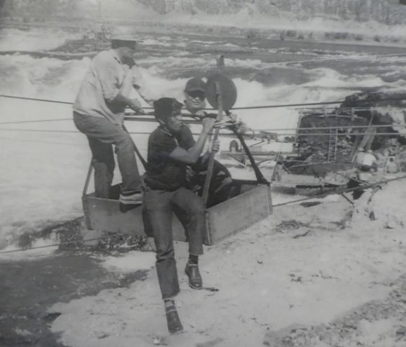 This photograph was taken in 1956.
 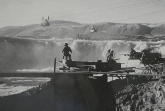 This photograph was taken in 1940.
 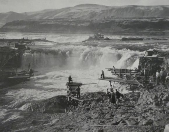 This photograph was taken in 1949.
 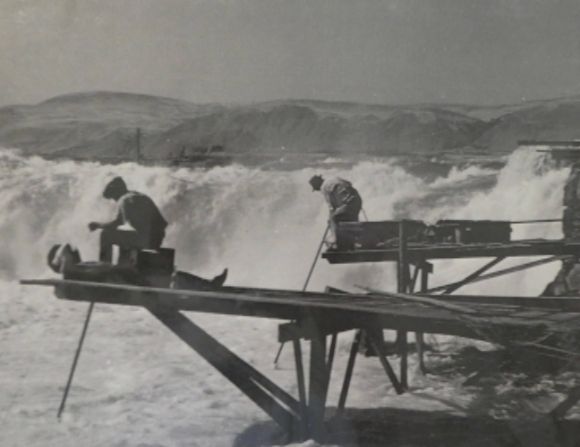 This photograph was taken in 1955.
 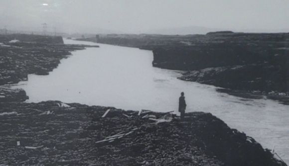 This photograph was taken in 1955. It shows the Five Mile Rapids.
 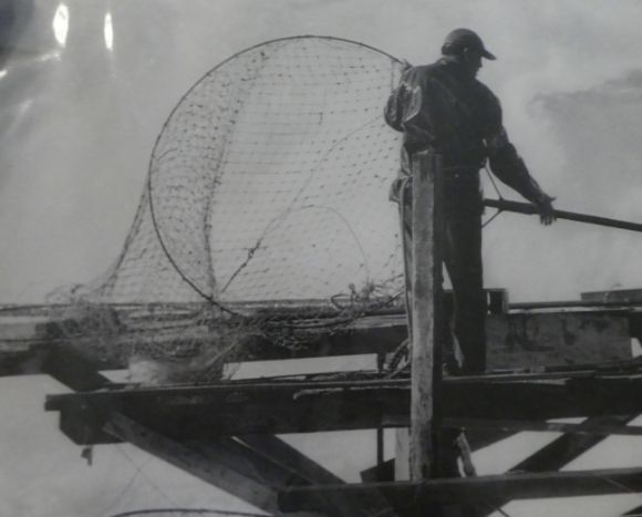 This photograph was taken in 1956.
 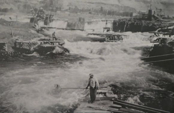 This photograph was taken in 1956.
 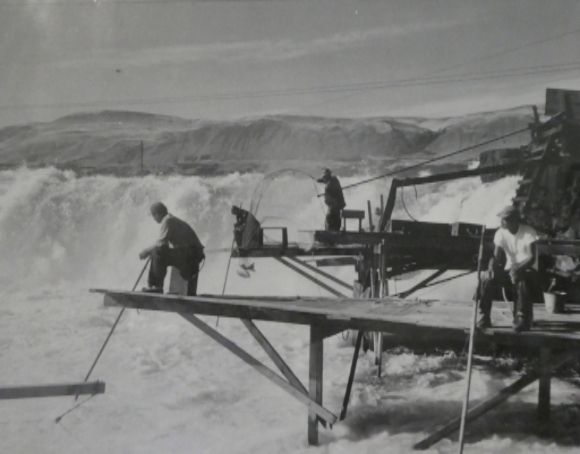 This photograph was taken in 1943.
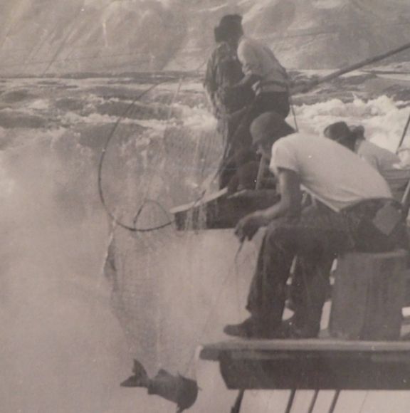
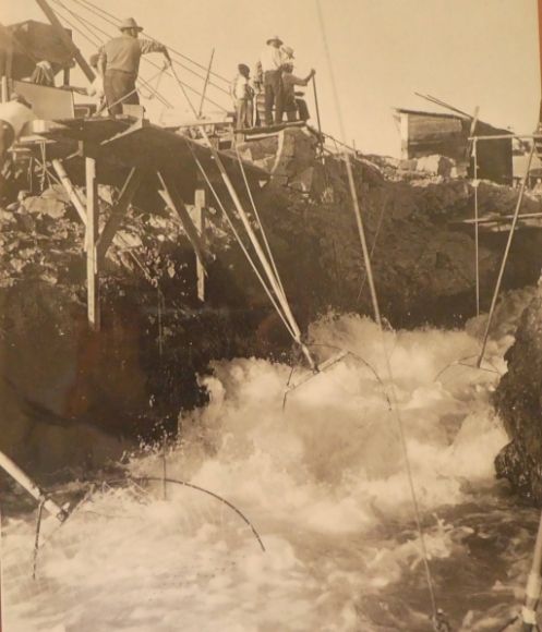 This photograph was taken in 1953.
 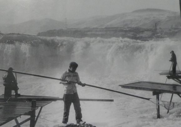 This photograph was taken in 1947.
 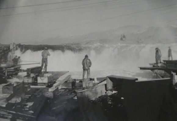 This photograph was taken in 1956.
 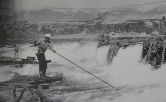 This photograph was taken in 1956.
 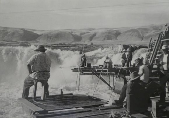 This photograph was taken in 1951.
 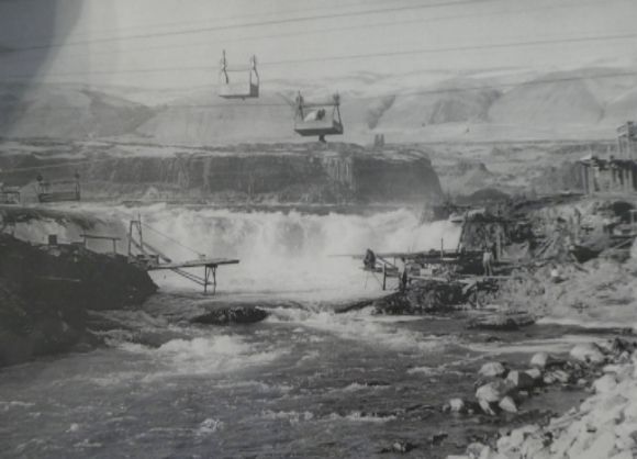 This photograph was taken in 1956.
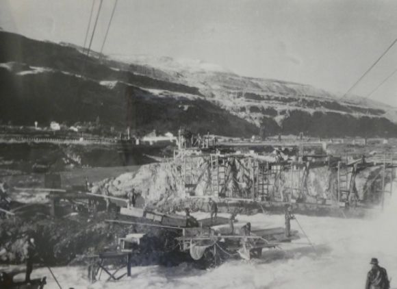
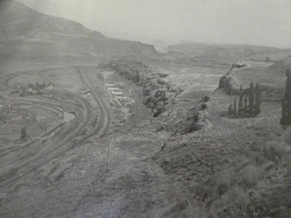 The white buildings in this 1956 photograph are the government housing built for the Celilo Indians.
 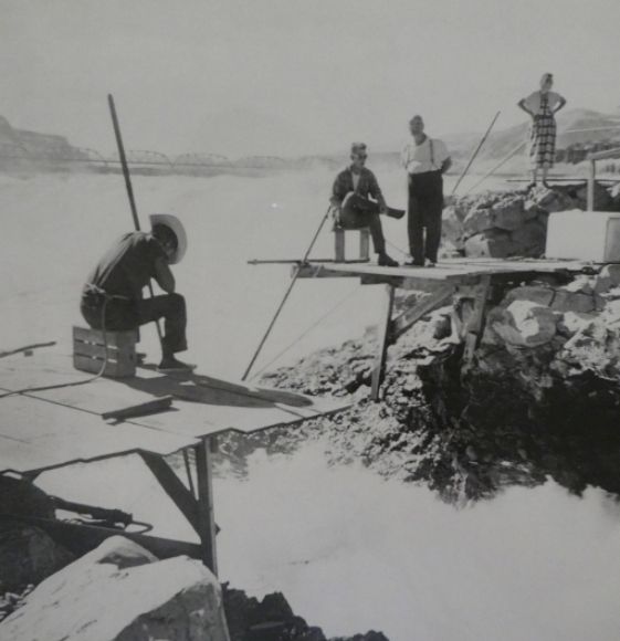 This photograph was taken in 1956.
 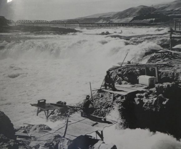 This photograph was taken in 1950.


Leave a Reply