Tulum, located on the Yucatan Peninsula of Mexico, was one of the last cities built and inhabited by the Maya. The earliest date found on a stele at Tulum is 564 CE and the city flourished from about 1200 to 1521. It was a major link in the rather extensive trade route of the Maya. Its seaside location made it a transportation hub: both maritime and land trade routes converged here. Its fortifications show that it was an important site, one which had to be defended from raiders and enemies.
The site’s current name, Tulum, is from the Yucatec Mayan word for fence or wall and refers to the site’s fortifications. There is some indication that the old name for the site may have been Zama, meaning “city of the dawn” in reference to its eastern location.
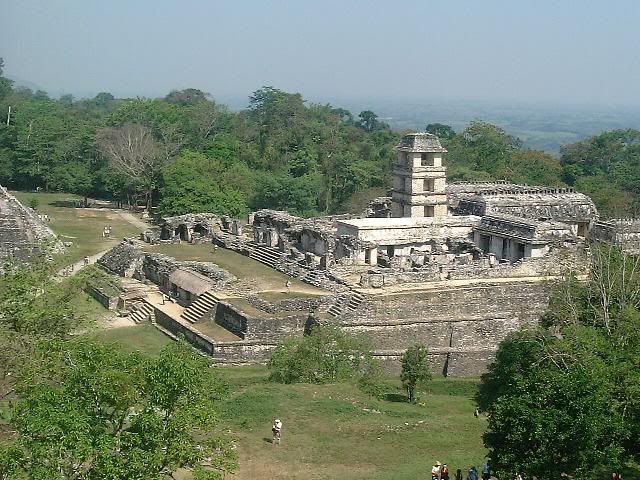
On one side Tulum was protected by steep sea cliffs. On the landward side, the city was protected by a wall that averaged three to five meters (16 feet) in height. The wall was about eight meters (26 feet) thick and ran for some 400 meters (1,300 feet) on the side parallel to the sea. The walls which ran from the parallel wall to the seaside were about 170 meters (560 feet) long. On the southwest and northwest corners there are small structures which probably served as watchtowers. There are five narrow gateways in the walls: two on the north wall, two on the south, and one on the west.
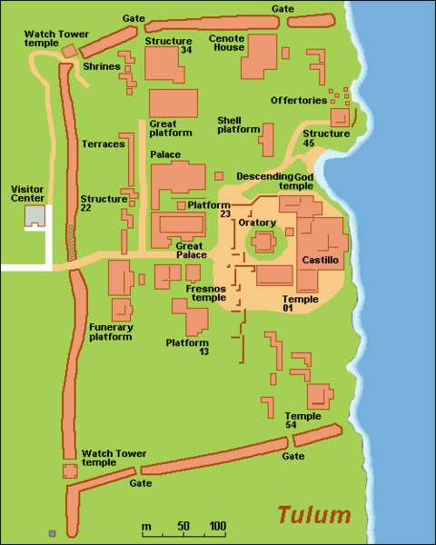
Fresh water for the city was provided by a small cenote near the northern side of the wall.
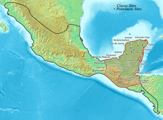
With regard to trade, the artifacts which archaeologists have found at the site come from central Mexico and Central America. The trade goods included copper rattles and rings from the Mexican highlands; flint and ceramics from all over the Yucatán, jade and obsidian from Guatemala. The obsidian came from quarries in Ixtepeque in northern Guatemala which is 700 kilometers (430 miles) from Tulum. From the amount of obsidian found at Tulum, archaeologists feel that Tulum was a major center for the obsidian trade.
With regard to trade routes, the Río Motagua and the Río Usumacincta/Pasión would have allowed seafaring canoes access to both the highlands and the lowlands. The Río Motagua starts from the Guatemalan highlands and flows to the Caribbean. The Río Usumacincta/Pasión system also originates in the Guatemalan highlands, but empties into the Gulf of Mexico.
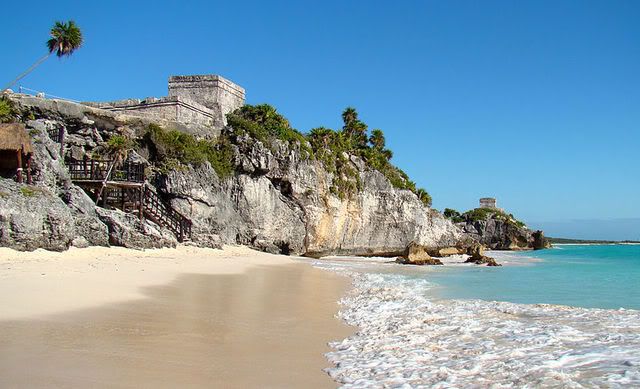
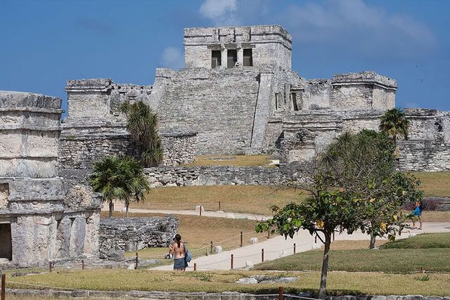
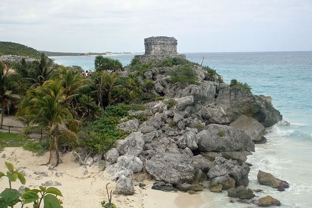
There is a cove and landing beach in a break in the sea cliffs that would have been perfect for trading canoes coming in. This characteristic of the site is probably one of the reasons the Maya founded the city of Tulum here in the first place. The structure presently known as the Castillo has a small shrine which was used as a beacon for incoming canoes. It marks a break in the barrier reef that is opposite from the site. The Casillo is 7.5 meters (25 feet) tall and the lintels in the upper rooms have serpent motifs carved in them.
One of the most important gods of Tulum appears to have been the Diving or Descending God. There are many depictions of this god in the murals and other works around the site.
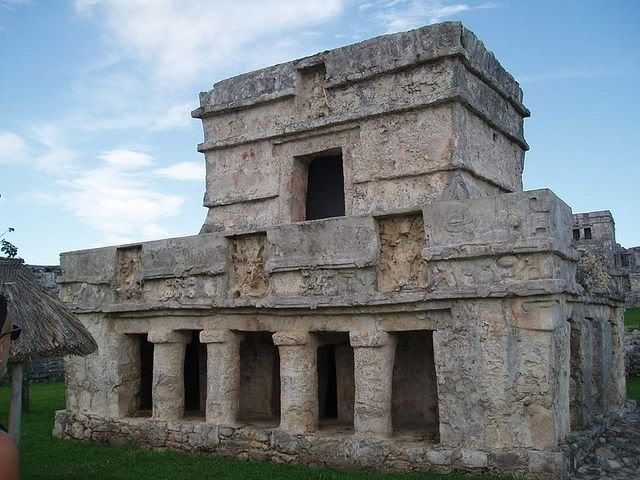
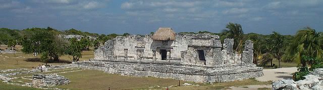
The Temple of the Frescos is shown above. Many people feel that this is one of the most spectacular buildings at Tulum. It has both a lower gallery and a smaller second story gallery. Niched figurines of the Maya Diving God and Descending God decorate the façade of the temple.
The Temple of the Descending God is shown above. This is located in the site’s central precinct.
The Temple of the Wind Gods is shown above.
Tulum continued to be occupied for at least 70 years after the Spanish invaded Mexico. The Spanish first discovered the city in 1518 and by the end of the century it was deserted.

Leave a Reply