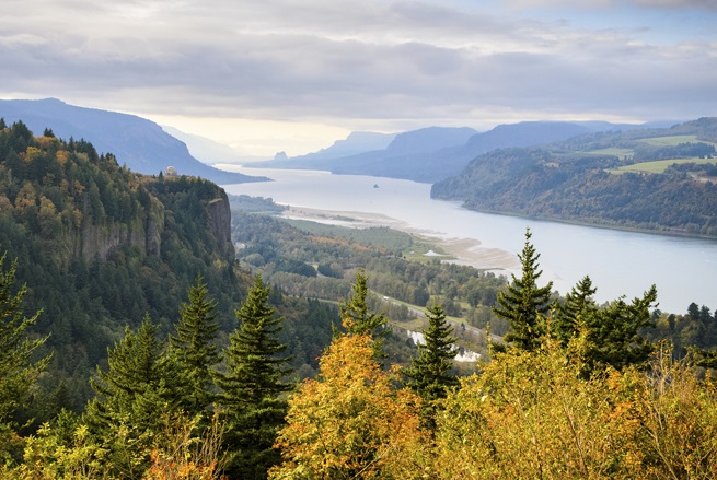
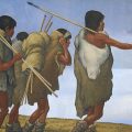
In 1805, the American Corps of Discovery under the leadership of Meriwether Lewis and William Clark made its way down the lower Columbia River. This area, from Celilo Falls near the present-day Oregon city of The Dalles, to the Wapato Valley (the Portland Basin), to the mouth of the river, was inhabited by numerous Chinookan-speaking Indian nations. The many villages along the river were linked through trade and through intermarriage. As Lewis and Clark traveled along the lower Columbia River, they found that villages and towns were numerous.
The lower course of the Columbia River and the Pacific Coast adjacent to its mouth have changed significantly over time. During the past 5,000 years dunes have formed, creating a ridged topography. C. Melvin Aikens, Thomas J. Connolly, and Dennis L. Jenkins, in their book Oregon Archaeology, explain: “The Clatsop Plains is a ridged landform of stabilized dune sand stretching between the Columbia River and Tillamook Head. The sand derives primarily from Columbia River sediment that is returned to the outer coast due to high energy waves.”
Earl Dune Site:
American Indians first began using the Earl Dune site (35CLT66) about 1,350 years ago. C. Melvin Aikens, Thomas J. Connolly, and Dennis L. Jenkins report: “The initial occupation appears to have been on an open sandy beach on the ocean side of the dunes, where marine fishes (primarily hake and sculpin) were harvested, and razor clams were opportunistically collected.”
Occupation of Earl Dune site was short-term. As the dune accumulated more sand, occupation of the site became less frequent and use of the site ended about 1,200 years ago.
Palmrose Site:
The Palmrose site (35CLT47) is located at the southern end of the Clatsop Plains. The site was first occupied about 3,900 years ago and by 2,700 years ago the people had constructed a large rectangular plank house. This is the earliest plank house known on the southern Northwest Coast Culture Area. This house was approximately 6 meters (20 feet) wide and at least 12 meters (40 feet) long. The house was probably similar to the plank houses that early European and American explorers saw in the area.
The Palmrose site was a permanent site and is characterized by a large shell midden. The people who lived here were harvesting horse clam, butter clam, and littleneck clam. Archaeologists also found evidence of 23 species of birds, 23 species of fish, and 14 species of mammals. The remains of mammals included both sea mammals (whales, sea otters, sea lions, and fur seals) and land mammals (deer and elk were most common). In general, it appears that sustenance was largely based on marine and littoral resources.
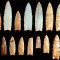
With regard to tools, the archaeologists found a variety of projectile points, atlatl weights, mortars, stone mauls, antler digging stick handles, antler splitting wedges, composite bone harpoon points, and shark-tooth pendants.
Archaeologists also found a number of carved bone and antler artifacts with motifs similar to those found farther north. C. Melvin Aikens, Thomas J. Connolly, and Dennis L. Jenkins report: “These similarities show clearly that close contacts were being maintained over great distances up and down the coast by 2,700 years ago. These ancient connections may be a factor in the presence of Salish languages in Oregon, which otherwise dominate the Washington and southern British Columbia coasts to the north.”
The Palmrose site was abandoned about 1,600 years ago.
Par-Tee Site:
Indian people were occupying the Par-Tee site (35CLT20) near present-day Seaside, Oregon by about 1,400 years ago. The people were exploiting sea mammals as well as fish and shellfish. They were also hunting elk. Some of their tools were made out of modified whale bones. Houses at this site appear to have been circular.
Avenue Q Site:
While Indian people first began occupying the Avenue Q site (35CLT13) about 3,500 years ago, the most intense period of occupation was between 1,700 years ago and 1,000 years ago. In modern times, the site’s shell midden, which was about 10 feet deep, was mined to obtain material for road building.
Indian people at this site had a subsistence focus on marine environments. Fish, particularly halibut, lingcod, and cabezon, predominate. Among the mammal bones found by archaeologists at the site, 73% were from marine mammals (sea otters, harbor seals, sea lions, and whales).
Eddy Point and Ivy Station:
About 25 miles upstream from present-day Astoria are the Eddy Point (35CLT33) and Ivy Station (25CLY34) sites. Both of these date back about 3,000 years. While deer and elk bone was common at both sites, there were also some harbor seal bones. Archaeologists also uncovered evidence of fish (salmon, sucker, sturgeon, and marine fishes), waterfowl (swan, duck, goose), and marine shellfish. While archaeologists found no evidence of house structures, they feel that both of these were village sites.
Meier Site:
At the Meir site (35CO5) archaeologists uncovered the remains of a large Chinook-style plank longhouse. It is estimated to have been 14 meters wide and 35 meters long. Radiocarbon dating shows that it was initially constructed about 700 years ago and that it remained occupied until historic times. The archaeological data shows that the main wall and roof support members had been shored up and/or replaced about eight to ten times during the life of the house.
Down the center of the house were a series of formal boxed hearths. The ethnographic record shows that each of these hearths would have served from two to four related families. Houses of this type were generally occupied by several related families. Each family would have a bedroom area which was a platform attached to the outside wall.
The longhouse at the Meier site had storage pits or cellars along both sides of the hearth area. These pits had been dug, filled, and re-dug many times during the centuries that the house had been occupied. When in use, the pits were probably covered by flooring planks. With regard to the archaeological evidence in the pits, C. Melvin Aikens, Thomas J. Connolly, and Dennis L. Jenkins report: “The pits yielded an abundance of fire-cracked rock and tens of thousands of bone fragments from elk, deer, salmon, sturgeon, and other animals, the remains of food that was stored, cooked, and eaten in the house.”
Cathlapotle:
When Lewis and Clark journeyed through the Lower Columbia River area, they encountered the village of Cathlapotle which was across the river from the Meier site in what is now the Ridgefield National Wildlife Refuge in the state of Washington. They reported that this was a large village with about 14 houses and a population of about 900. Archaeological investigation of the site began in 1991 and continued until 1996. Dating shows that the site was occupied from the mid-1400s until the 1840s.
The archaeologists found six house sites in two parallel rows on a ridge above the river’s high water level. The houses ranged from 60 feet to 200 feet in length and from 24 feet to 36 feet in width.
As with the longhouse at the Meier site, archaeologists found large storage pits or cellars in the longhouse sites. Some of these were six feet deep and when the houses were occupied, they would have been beneath the sleeping platforms that lined the walls.
With regard to the Cathlapotle site, Ruth Kirk and Richard Daugherty, in their book Archaeology in Washington, report: “So long as a site is not threatened by disturbance, such as from land development or erosion, today’s archaeologists deliberately study only part of it. They leave the rest for the future, a time sure to have new insights, new investigative techniques, and new research questions.”


Leave a Reply